There are not many trails that have both alpine mountains and tropical rain forests. El Choro has is all. Here is how we did it

This is one of the most famous trails in Bolivia and yet, when we were there in mid September, we were almost the only ones walking it. The weather was great for us and we enjoyed an amazing hike, with a few surprises on the way. The hike is not hard, and can be easily done without a guide, but the altitude does take a toll. Prepare yourself by acclimatizing to the altitude before you start to avoid altitude sickness. And ask the locals what is the state of the bridges, you will have to cross a river and from time to time bridges get washed away. It is dangerous to cross the river with no bridges, but possible in a few places, but in any case knowing what to expect will help you plan better and maybe even change the course to one of the Inca trails connecting to El Choro
The hike
The stats:
64km | 4 days | Max alt: 4872m | Min alt: 1056m | Ascent: 2692m | Descent: 5619m
The route:
The trail itself took us 3 days, the last day was to reach Coroico from where we ended, and us being us, we walked it as well. We saw people doing the trail in 2 days, with a guide, basically running without equipment. We preferred to walk in our pace and enjoy the view. The main things to consider are the altitude and the amount of water to take. We avoided the water calculations by taking some water purifying pills so we could fill our bottles from every water source, and we definitely used them.
Day 1 - From point 1 to point 3 | 14km | 8hr
We packed our things the day before, these were the essentials
65L, 17kg backpack (for me)
40L, 12kg backpack (for Lucy)
2 people, 3 season tent
2 sleeping bags
Food
Water
Water purifying pills
Clothes for warm and cold weather
We did manage to make the mistake of taking ALL of or stuff with us, instead of leaving half of it for safe keeping in La Paz, so we did carry some unnecessary weight.
We started our day around 7am in La Paz, took a minibus to the center where we found another minibus going through La Cumbre - the starting point of the hike.
7am is too early for us so we fell asleep and, of course, missed our stop by a couple of kilometers that were added to our total for that day.
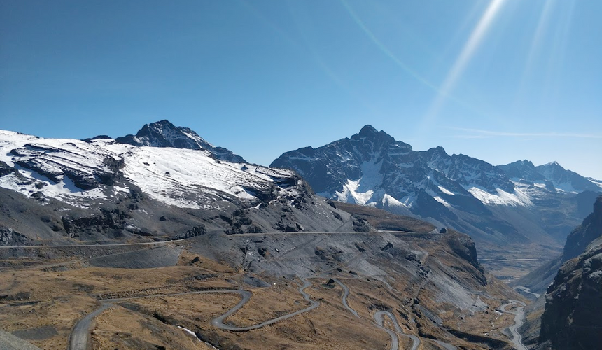
The day started with going up about 300 meters, which was probably the hardest 2 hours of the whole hike. We felt every meter of those 300 but once we reached the high point of the hike, and were able to look around the the snowy peaks and what is waiting for us it was instantly worth the suffering we endured to get there.
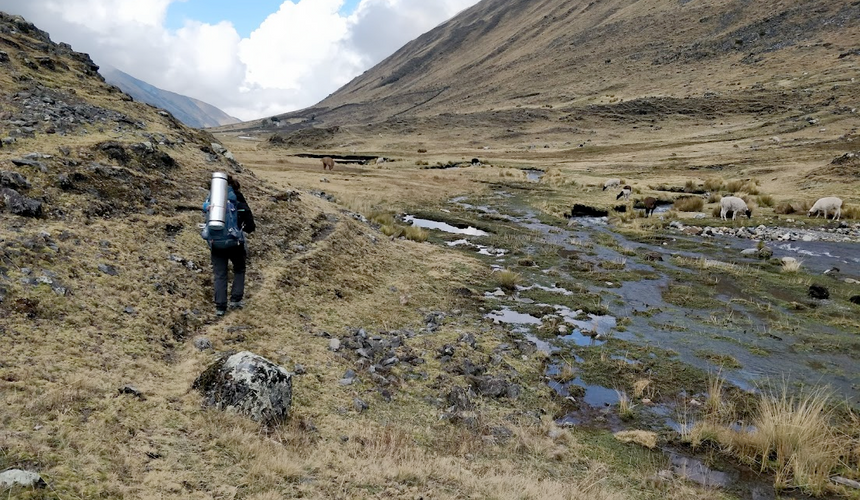
From that point on the only way is down. On the way we saw a river that is starting to form from the melting snow, rains and probably some underground water sources and more and more llamas started to appear. We also passed through few Incan ruins, which were amazing to see, but the highlight of our day was the shop at point number 2. There we signed the travelers book and got ourselves a beer to enjoy the moment. Imagine that - a beer, at 4700m altitude! True happiness!
After our beer break we kept walking for a few more hours, until we reached point 3 which is a toll point that you need to pay 20 Bolivianos (September 2019 pricing) for the upkeeping of the trail. There was a house there and a few people so we did not want to camp there as we preferred something more private, so we continued to walk for about 30 more minutes until we found a nice misty place to put up our tent.
Day 2 - From point 3 to point 4 | 14km | 7hr
We woke up with the sun around 7am, and when I popped my head out of the tent I saw 2 amazing views. The first was being surrounded by llamas that were eating around the place our tent was standing at. The second was the amazing view that I could see now that the mist from the evening cleared out. We quickly packed and started walking.
The views had changed from snowy peaks to green hills all around, and the river we saw forming the day before had already turned to a wide river with a decent current. There were a few points that we had to cross the river back and forth, and in one of those point the bridge has been washed away a few weeks before we were there. Lucky for us, the local had already built a temporary bridge which we used to cross (this is why it is important to ask about the state of the bridges before you begin). We ended our day reaching point 4, a camping site called Buena Vista and spent the night there.
Day 3 - From point 4 to point 5 | 20km | 9hr
We woke up and started our day, this is when we saw the only people other than us on the trail, a couple with a guide that were running through the trail in 2 days.
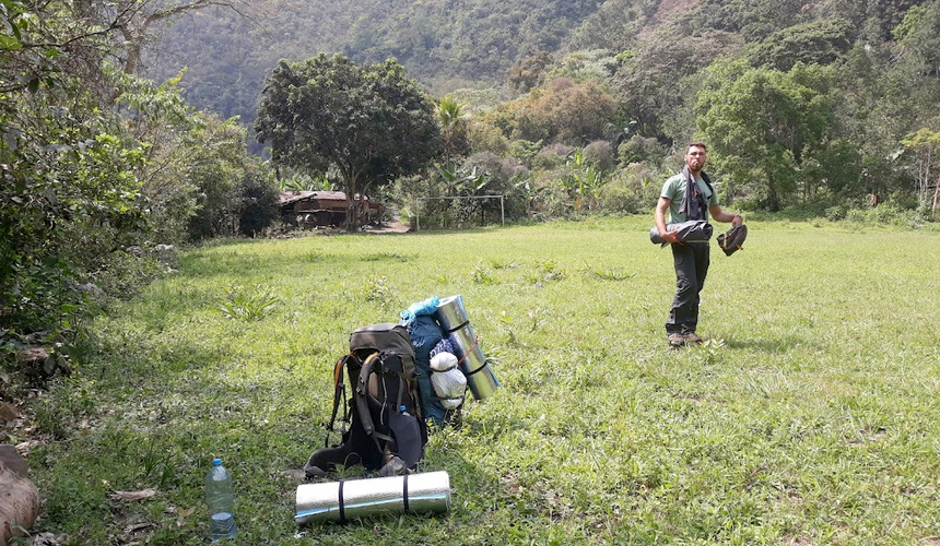
This day was definitely the warmest, as the altitude was reaching 2000m. The views changed once again, this time to a tropical forest that we were walking through, and the river turned to a big strong river. This day was the longest for us, but as the altitude was friendlier, and the decline was less steep, it just meant that we need to walk more. Once again we found ourselves using alternative bridges to cross the river, and looking for places hiding from the sun.
The trail ends at a small shop called Chairo (point 5), where you can buy some snacks and refreshments (and beer!) after the long hike. We re-stocked and continued walking for a while until we found an empty field to build our tent in.
Day 4 - From point 5 to point 6 | 16km | 8hr
The trail was finished, but we decided to keep walking until we reach Coroico (point 6) and to rest up there. There was nothing special to see this time around, as the whole way we were walking on a road. At some point at around midway we managed to hitchhike and catch a ride that saved us some decent walking time. We stayed the night in one of the hostels in Coroico to rest and charge our batteries, and took a minibus back to La Paz the next day.
Final thoughts
This hike is very special for us. This was the first hike we did together and the only one we ended up doing in Bolivia. El Choro took us through snowy mountains, green highlands, down to a tropical rain forest and back to civilization. Until today we did not have any hike that had that range of environments as El Choro and it is still one of our favorite memories from Bolivia.
Knowing other people that did the trail I understood that we were extremely lucky to have the trail all to ourselves, as it is one of the most popular trails in the country and it gets crowded in the high season (May-August).
-modified.png)


Comments